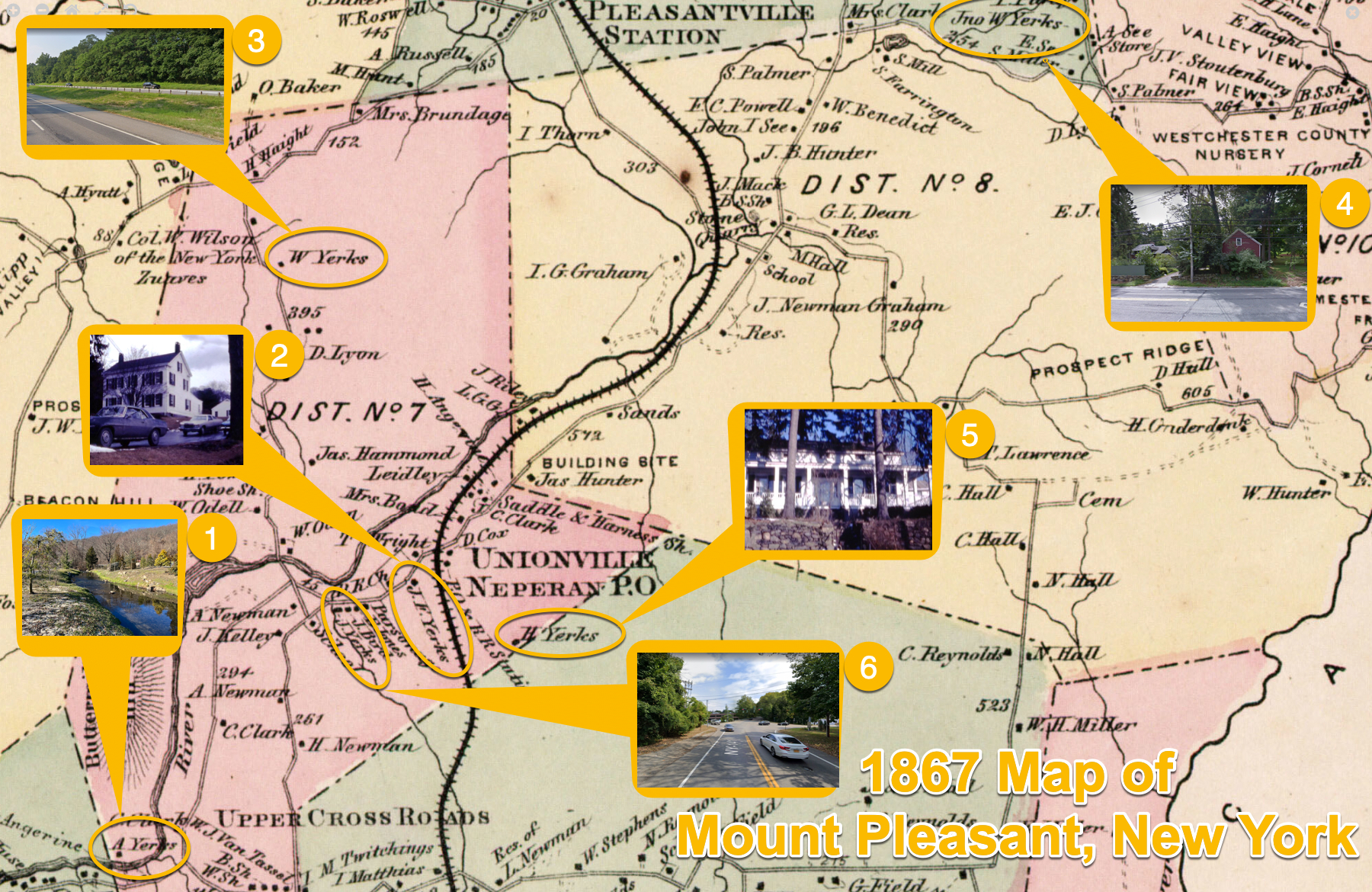
The Yerks Family’s of Neperhan / Unionville/ Hawthorne and Pleasantville in 1867
1 – A Yerks A Yerks > William Brook Yerks (Mary) > William Yerks (Catherine) Location: Rosedale Nursery, Saw Mill Road, Hawthorne, New York Most likely, the site of the farmhouse that Catherine See & William Yerks (my wife’s 6th great grandparents) and their ancestors lived in while tending the 300-acre family farm in [...]
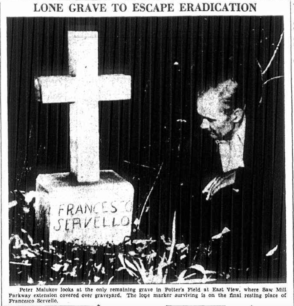
The Saw Mill Parkway’s Path Over the Eastview Almshouse Cemetery
A 1940 map of the Eastview area overlaid on a 1925 map of the same area show exactly how the Saw Mill Parkway was paved over the Eastview Almshouse Cemetery. SAW MILL RIVER PARKWAY TRAFFIC ROLLS ON GRAVES OF PAUPER DEAD Only one headstone remains standing at County's Old Burial Ground at [...]
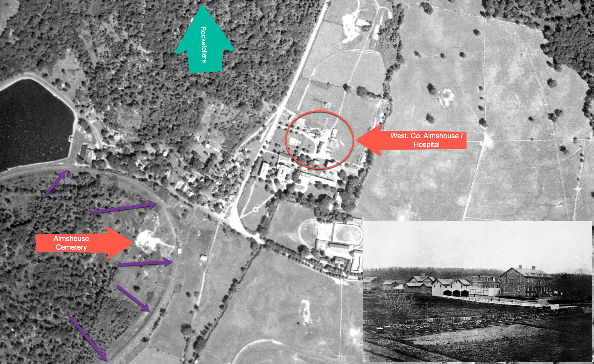
How Eastview, New York Looked in 1925
By Philip HayesPublished On: January 12, 2022Categories: Maps, Places: Eastview, Walking In The Footsteps of Our AncestorsTags: Almshouse, Cemetery, Eastview, Poor Farm, Rockerfeller, Westchester CountyIn this aerial photograph, you can clearly see where the old Westchester County Almshouse Complex stood. In the overlaid picture, the two foremost buildings can be seen in the red circle. You can also see the Almshouse cemetery on the other side the old Putnam (Ole Put) railroad tracks before is was buried beneath [...]
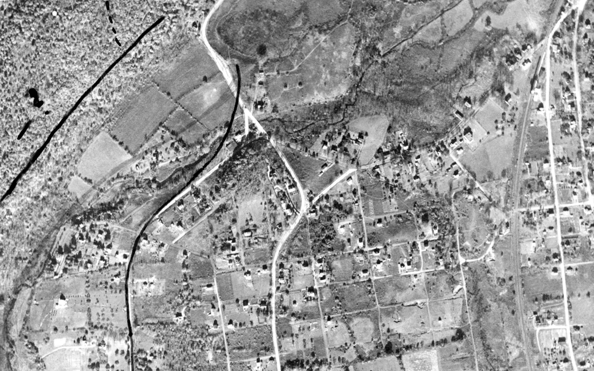
1925 – 2022 Photo Comparison of Unionville (Hawthorne), New York
Many historic things happened in this area during the revolutionary war. It is hard to appreciate it with the land have undergone so may signifiant infrastructure changes. But this overlay of a 1922 digital map of the area, overlaid on top of a 1925 arial photo of the area will help you understand better [...]
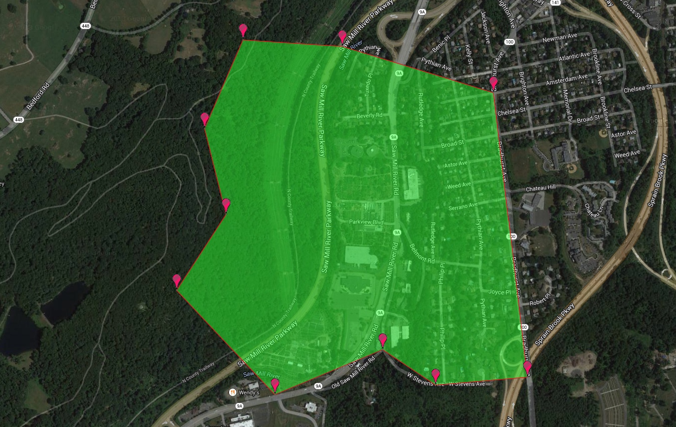
Where Is Catherine Yerks’ Farm?
This is a 1840 Map of the Yerks farm, overlaid on today's Google Map. Move the slider to change the view.